Earth – Item #SL-333
Classic StarLab Cylinder
Classic StarLab Cylinder
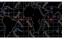
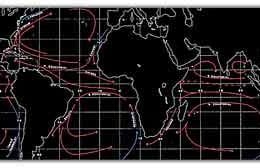
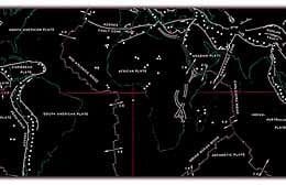
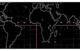
This cylinder is a projection of the entire terrestrial globe including all of the earth’s land and ocean masses. Longitude is displayed at intervals of 15º, latitude is displayed every 10º, with a scale of projection of 1 inch = 40 miles. It is superior to flat maps in its total elimination of distortion, and is useful for studying weather patterns, ocean currents, time zones, social studies and current events. For the study of geography, earth science, geology and navigation.Note: also available, Item #SL-335 Geocentric Earth (view from the center of the earth)


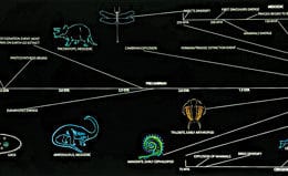
 SL-336 – Geologic Time